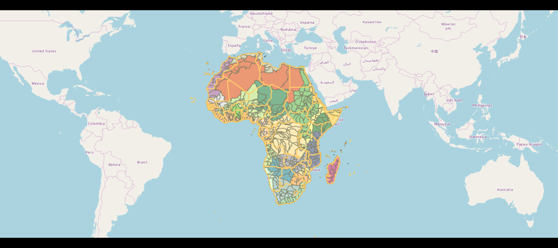
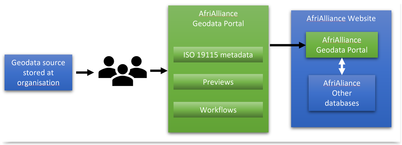
AfriAlliance Geodata Portal
One of the innovative aspects of AfriAlliance is the multiple information source gathering approach for the purpose of water resources monitoring and forecasting. The inventory is based on a triple-sensor approach, looking into the capacity and efforts on human sensors (citizens, geo-crowdsourcing and communications), physical in-situ sensors (like weather station-based meteorological and ground-based water resource and hydrological networks such as stream gauging, groundwater, etc.) and space-based satellite sensors.
The content of these sources is described by metadata in the AfriAlliance geodata portal. It allows users to enter descriptions for all types of data, including satellite data, in-situ sensor data, citizen data, models, etc. and search for it. In this way, geodata sharing is stimulated between stakeholders in the AfriAlliance network.
Try the Geodata Portal here:
http://afrialliance.itc.utwente.nl/geonetwork
Download the Geodata Portal Tutorial
About the author

Related content
AfriAlliance Triple Sensor Approach
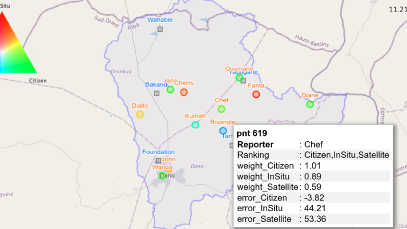
The AfriAlliance Triple Sensor monitoring approach permits to view and compare the accuracy of citizen-sourced, satellite and conventional ground station data on water and climate for a specific ...
Blog: Synergy in the Knowledge Hub: Linking AfriAlliance databases
The AfriAlliance Knowledge Hub contains a range of information of use to water and development professionals working in Africa. The databases in the Knowledge Hub provide detailed insight into water ...