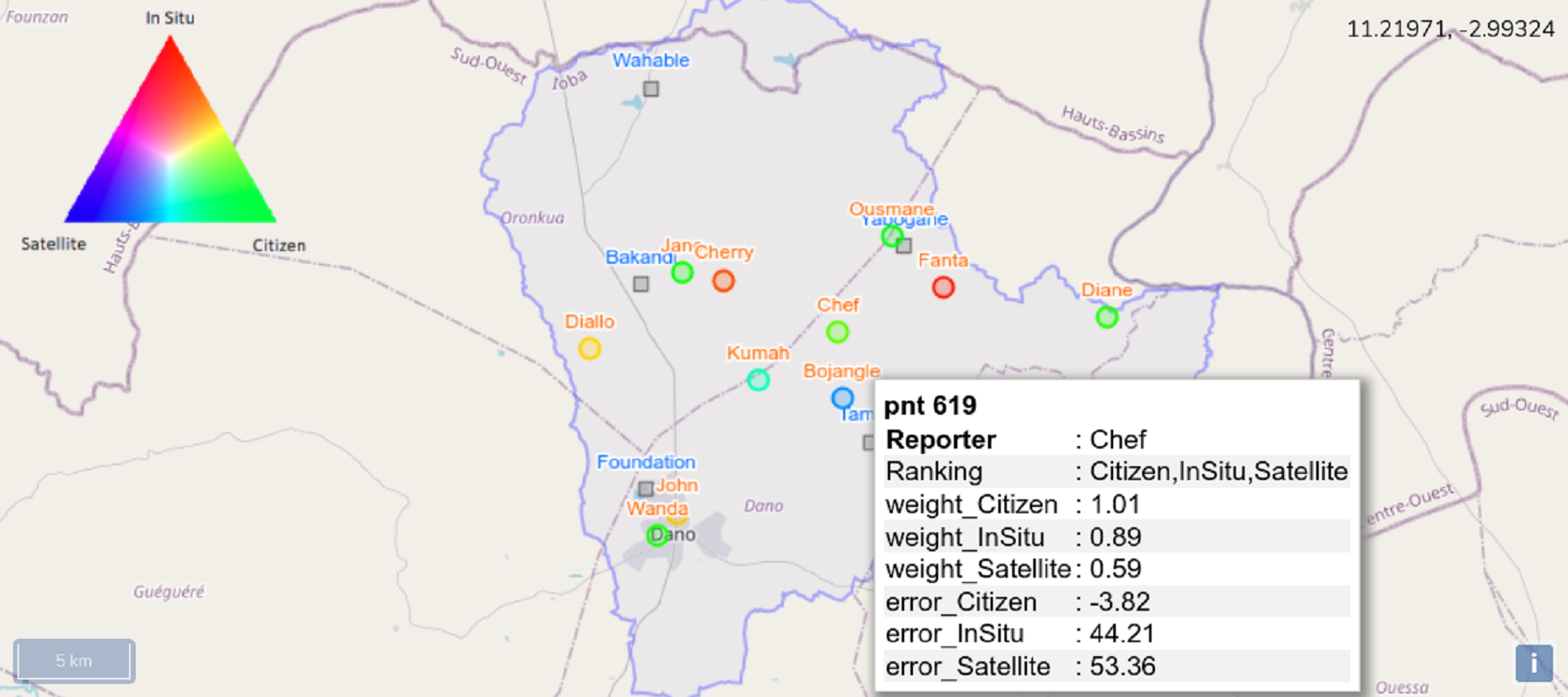
AfriAlliance Triple Sensor Approach
The AfriAlliance Triple Sensor monitoring approach permits to view and compare the accuracy of citizen-sourced, satellite and conventional ground station data on water and climate for a specific location and time period.
The method can be applied to any region, project area or location of interest and can be practiced on many typical climate, weather or water resources and continuous biophysical observation data (e.g. time series of meteorological soil, soil moisture, water surface or levels, the state of vegetation or crop conditions, health conditions, etc.).
Triple Sensor collocation is a statistical data analysis technique used to validate three independent observations at a location, when e.g. the true value is unknown. With this you can judge, which water or climate observation, i.e. your citizen observation, conventional near-by station data or a remotely sensed satellite look-up is most reliable. The method is derived from statistical covariance analysis on three data sources, and yields errors and correlations and permits to rank the reliability of the datasets, i.e. the best performing dataset on the locations. More application test and use cases are currently developed in Kenya, Ethiopia and the Netherlands.
Please click here to get the Demonstration Toolbox software and documentation http://ftp.itc.nl/pub/52n/AfriAlliance/.
Click here to see the Triple Sensor Collocation Demo: http://afrialliance.itc.utwente.nl/triplesensor/
Interested persons are invited to contact Chris Mannaerts (c.m.m.mannaerts@utwente.nl) for more information and exploration of further collaboration.
About the author

Related content
AfriAlliance Stakeholder Map
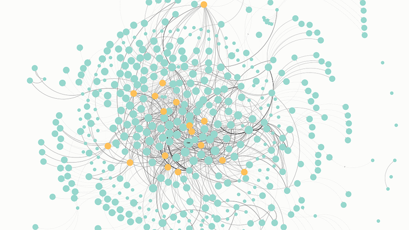
The innovative AfriAlliance Stakeholder Map has more than 570 connected elements: simple (organisations), combined (network, associations, platforms, etc) and temporary liaisons (projects). These are ...
AfriAlliance Newsletter no. 4
8 December 2017 Dear reader, Welcome to the fourth AfriAlliance newsletter! We have a full and productive couple of months behind us, and with this newsletter, we would like to update you about our ...